
Established March 1911
County Seat - Council
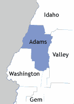
"Adams County was named for John Adams, the second President of the United States. The western boundary of the county is the Hells Canyon of the Snake. Powerhouses of the Oxbow and Hells Canyon dams of the Idaho Power Company are in Adams County. Council Valley was a meeting place for all the councils of the Nez Perce and Shoshoni Indians. The village of Council was incorporated in 1903. Packer John's Cabin, where the first Democratic Convention in the Idaho Territory was held, is in Meadows Valley just off Highway 55. Mines were developed in the 1880's and 1890's, but the mining boom died in the early 1900's. About 20 percent of Adams County includes the famous Seven Devils Mountains, noted for their ruggedness and grandeur." - "The Idaho Almanac," 1977 Edition, State of Idaho. map from almanac Adams Co. ISU Digital Atlas Neighboring Counties
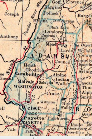
1917 map
Historic Post Offices
Starkey
1919 Preliminary Report on Mining Districts in Adams and Washington Counties
Hawley's History, 1920
Women Homesteaders on the Payette National Forest
Martial Law, 1931, "to prevent incenciarism;" in Idaho, Boise, Gem, Valley, Adams, Custer and Lemhi Counties
News
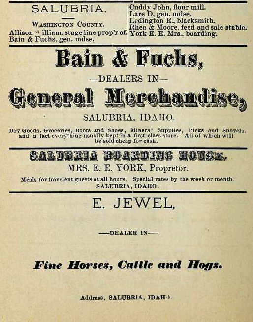
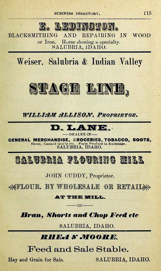
1866 Central and Western Idaho Directory. Salubria, William Allison, Bain & Fuchs, John Cuddy, D. Lane, E. Ledington, Rhea & Moore, Mrs. E. E. York, E. Jewel; Salubria, continued. Source - archive.org
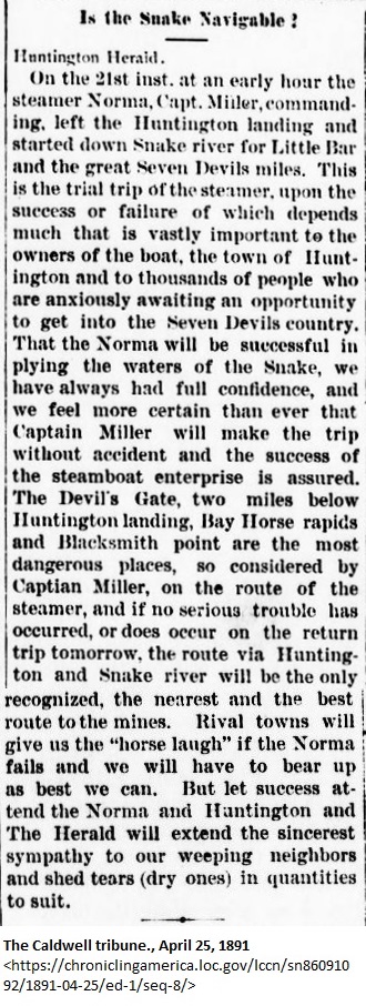
1891, Snake River Navigable, Capt. Miller, steamer Norma, started for Seven Devils
Links
Meadows Valley, Idaho
Adams Co., IDGenWeb
Adams Co. USGenweb Archives
Photographs
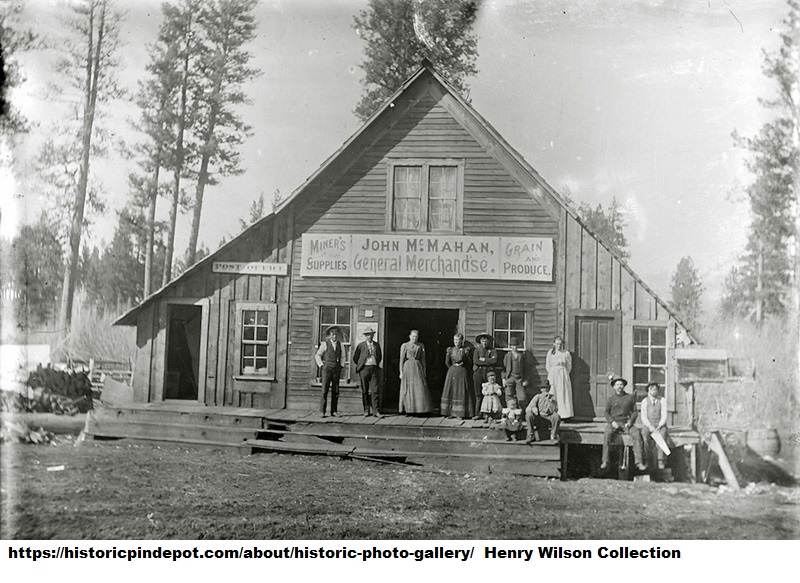
McMahan Store (photo from The Historic P&IN Depot). "John McMahan, General Merchandise. Mining Supplies, Grain & Produce" Post Office on left. McMahan was appointed post master of Meadows in 1896.
McMahan family history
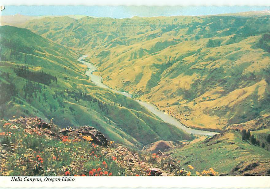
Hells Canyon
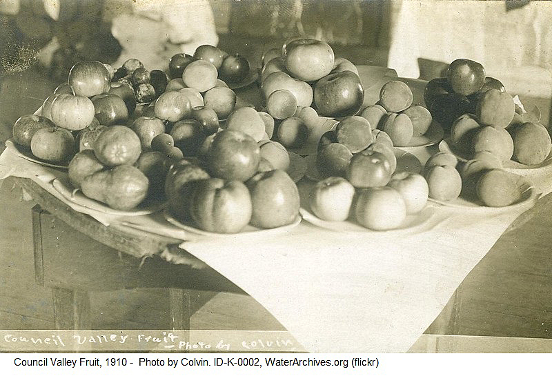
1910, Council Valley Fruit
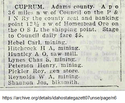
Cuprum, c. 1910-1920
1914, Cuprum business listings from Polk's 1914 Business Directory (follow link for rest of county)
Teasing for Candy at Mesa Orchards1
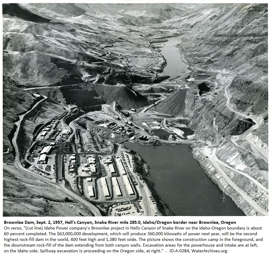
1957, Brownlee Dam construction site
1"Highway 95 passes through Indian Valley and climbs Mesa Hill thirteen miles north of Cambridge. The road cuts through what was once among a half a dozen largest fruit farms under single management in the world: Mesa Orchards Company." - Cort Conley. Idaho for the Curious/A Guide. Backeddy Books, Cambridge, Idaho. 1982.
"Mesa Orchards, Milepost 128. For more than half a century after 1910, an exceptionally large apple orchard covered these hills around Mesa. An eight-mile wooden flume brought water to these slopes. Chicago and other distant investors bought ten-acre shares in an orchard company to pay for this expensive 1,500-acre project. A town for 50 orchard workers was built here, and a 3 1/2-mile gravity tram hauled apples to the railroad siding below Mesa. This ambitious operation lasted until 1967. Sign number: 374." - "Idaho Highway Historical Marker Guide." ( Historical Markers in Idaho)

Webspace for this site is generously provided by Genealogy Village and Access Genealogy
Copyright © 2013 - Sharon McConnel. All Rights Reserved.