"ESTABLISHED 1911
COUNTY SEAT Nezperce
Lewis County is named for Meriwether Lewis of the Lewis and Clark expedition. The county's history is intertwined with that of Nez Perce County, from which it was divided. The Lewis and Clark expedition spent a month in the Clearwater River Valley near the town of Kamiah on its return from the Pacific Coast in May, 1806. Miners passed through what is now Lewis County on the way to the gold placers, but no communities were built until the Nez Perce Indian Reservation was opened for settlement and until the ultimate growth of agriculture, primarily wheat farming. Lewis County is one of the smallest counties in the state. and its principal industry is agriculture. - "The Idaho Almanac," 1977 Edition, State of Idaho.
Map from Almanac :: Lewis Co. ISU Digital Atlas :: neighbors
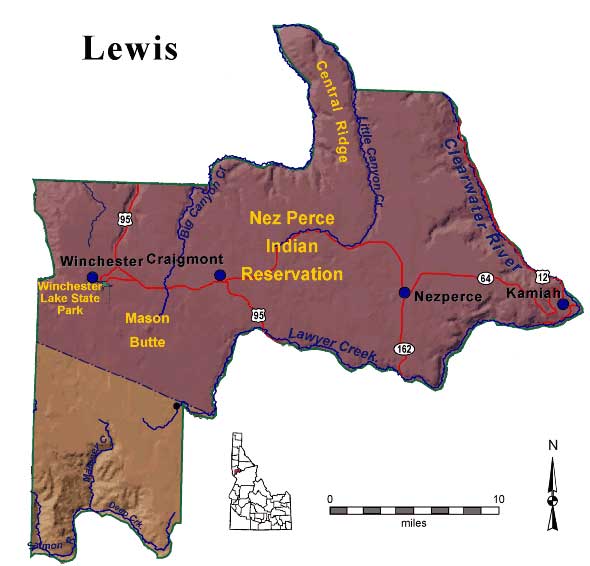
Cities and towns: Craigmont, Kamiah, Nezperce, Winchester
Nez Perce Indian Reservation
Hawley's 1920 History
Langley's 1876 Directory, alpha index
Photos
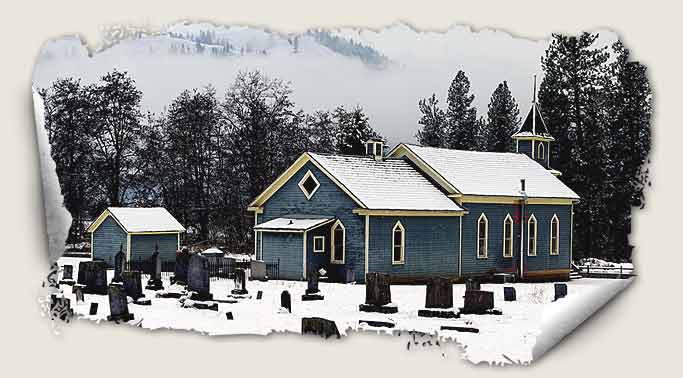
The First Indian Presbyterian Church of Kamiah was built in 1873 and is the oldest Presbyterian Church in Idaho. It is also the oldest Protestant Church. It has been in continuous use for over 130 years. The building was erected with fund provided for by the Nez Perce Treaty of 1863. The influential Nez Perce chief Lawyer served as the first elder and Henry H. Spalding preached there in the 1870s. Located nearby is the McBeth house where the Scottish missionaries Susan and Kate McBeth resided. Both are buried in the cemetery behind the Church. - "Idaho Heritage Trust."
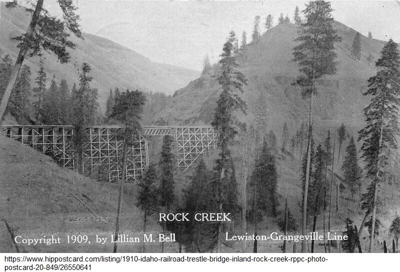
1909, Rock Creek Trestle - Camas Prairie Railroad; "This trestle of the Camas Prairie Railroad Company is located in Lapwai Canyon, Lewis County, Idaho. This particular section of the company rail line is referred to as the second subdivision of the Camas Prairie Railroad line. The trestle is located between Nucrag, Idaho, and Reubens, Idaho." - Steve Shook, flickr
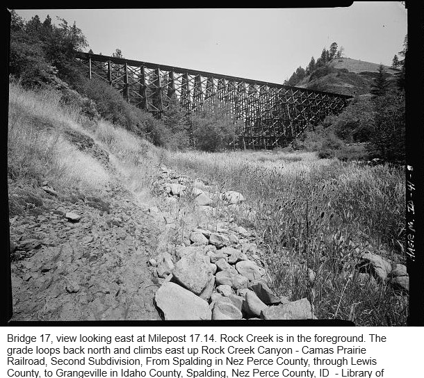
Bridge 17, Camas Prairie Railroad, Second Subdivision, From Spalding in Nez Perce County, through Lewis County, to Grangeville in Idaho County, Spalding, Nez Perce County, ID (1908 Initial Construction) Library of Congress
(Significance: It retains 6 of its original 7 tunnels and 44 of its more than 50 original bridges and trestles. These structures enabled the tracks to rise from a starting elevation of approximately 800' by the Clearwater River to a high point on the prairie of more than 3700'. The largest timber bridges and all of the tunnels are on the 12 miles between the Culdesac and the top of the grade at the edge of the Camas Prairie, climb close to 2,000; over a 3% grade. - Documentation compiled after 1968)
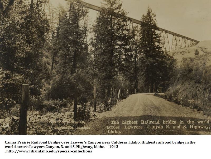
1913, Camas Prairie Railroad Bridge over Lawyer's Canyon
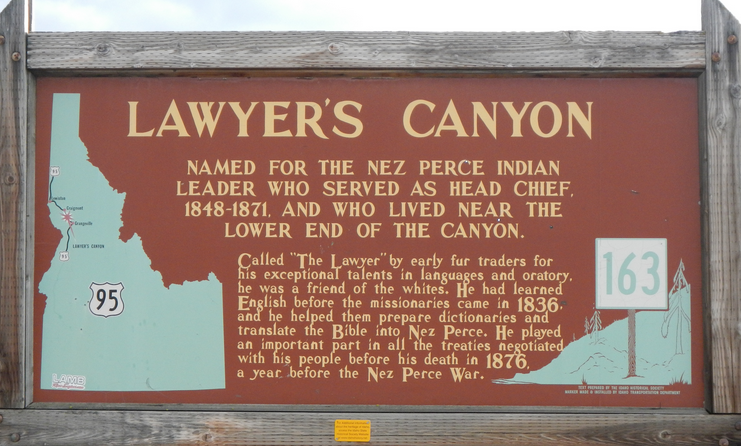
Lawyer's Canyon Historical Marker, "Called 'The Lawyer' by early fur traders for his exceptional talents in languages and oratory, he was a friend of the whites. He had learned English before the missionaries came in 1836 and he helped them prepare dictionaries and translate the Bible into Nez Perce. He played an important part in all the treaties negotiated with his people before his death in 1876, a year before the Nez Perce War. - Historical Marker Database
Links
Lewis County, IdGenWeb
Lewis County, ISU Digital Atlas

Webspace for this site is generously provided by Genealogy Village and Access Genealogy
Copyright © 2013 - Sharon McConnel. All Rights Reserved.